Client: Personal
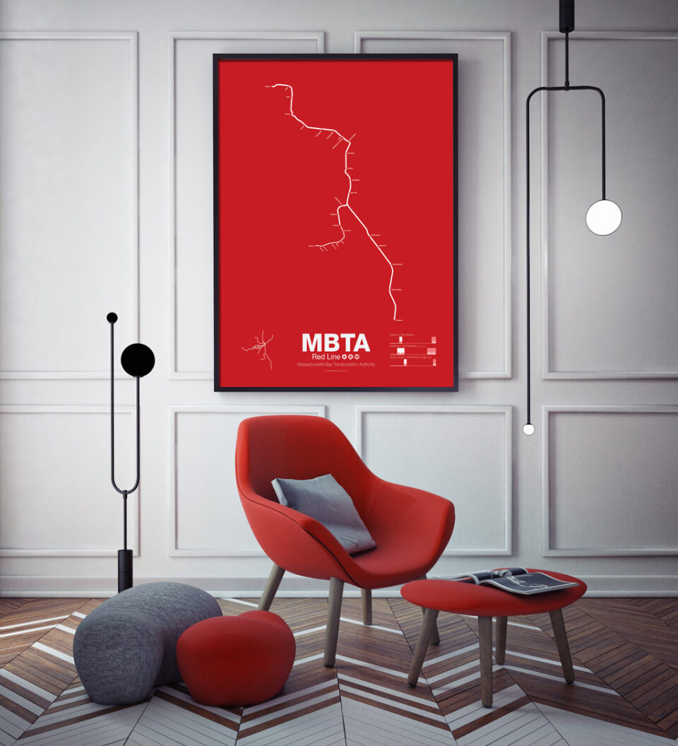
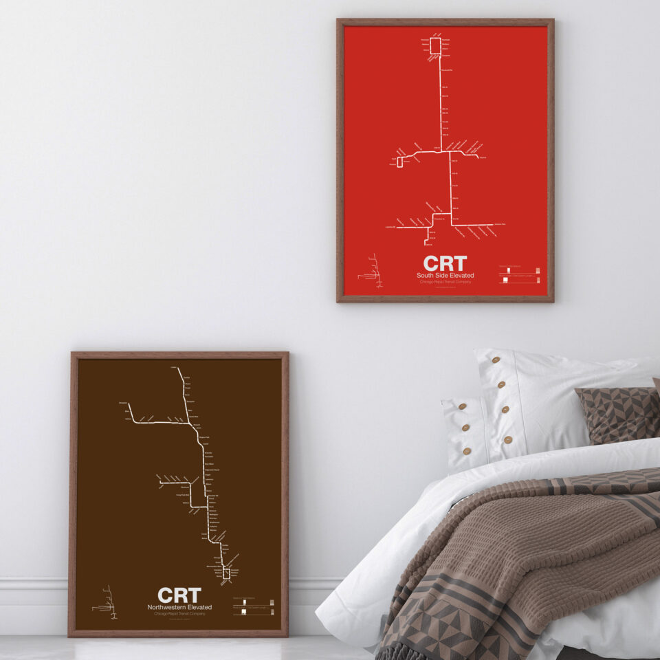
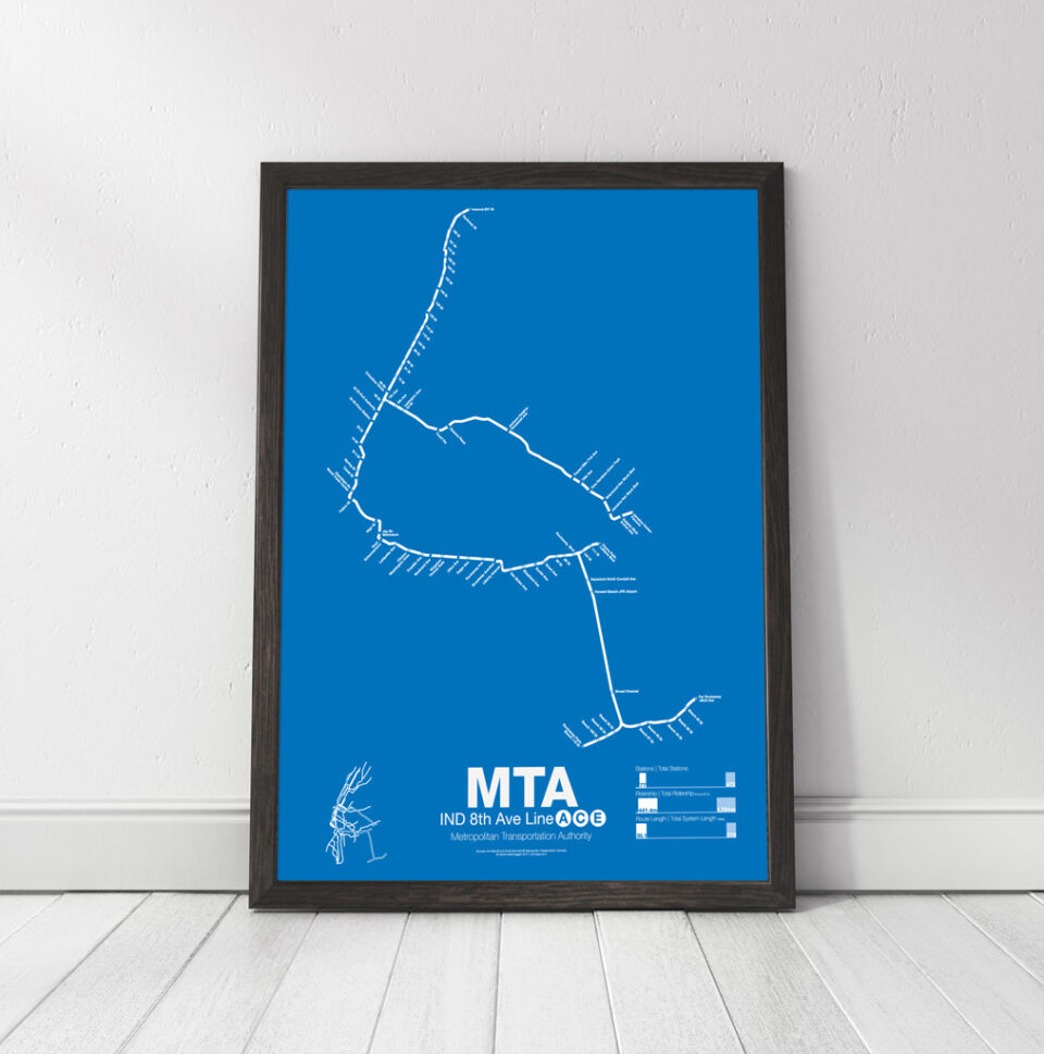
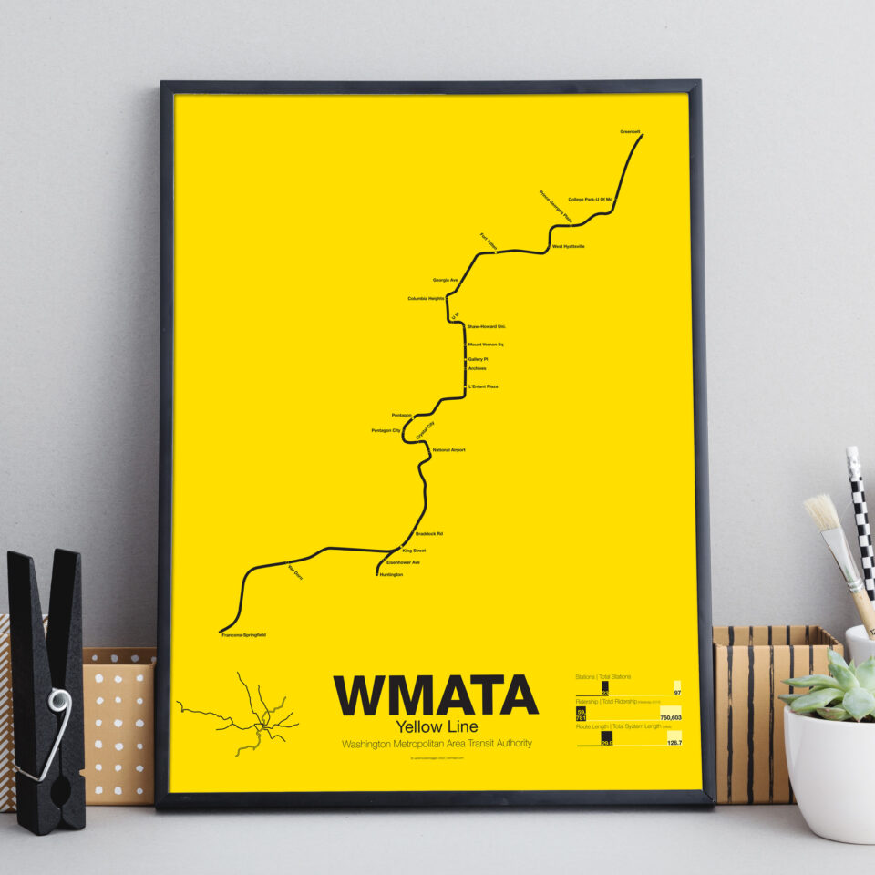
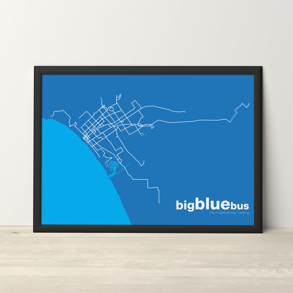
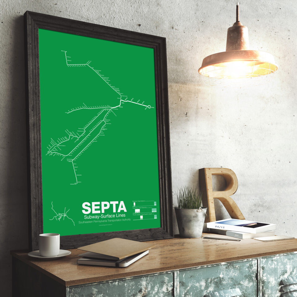
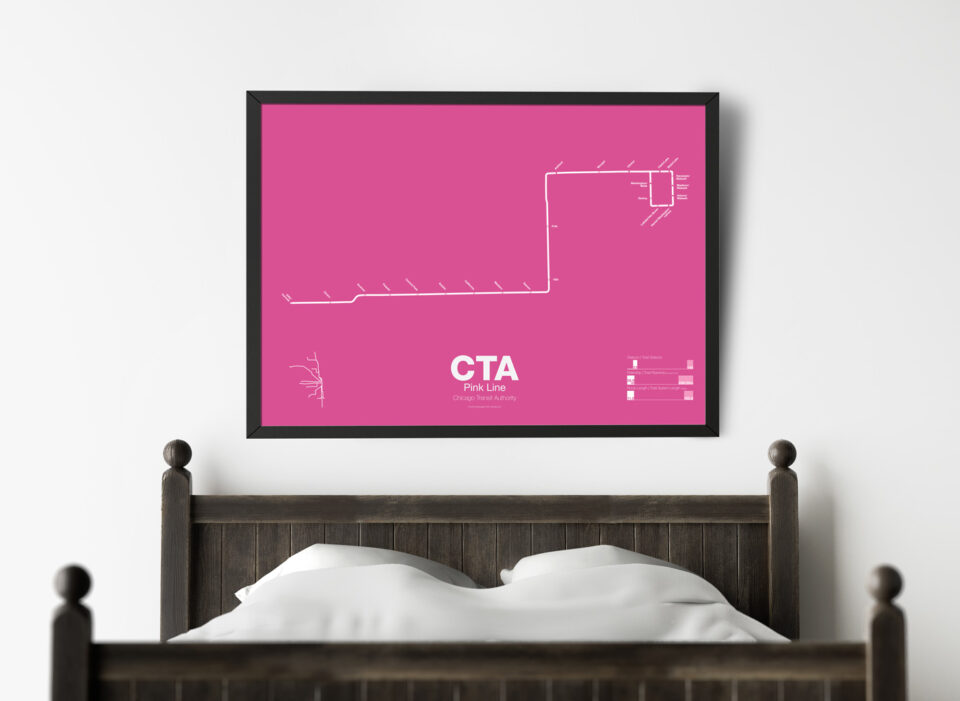
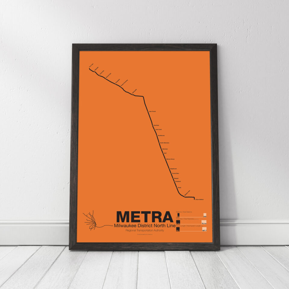
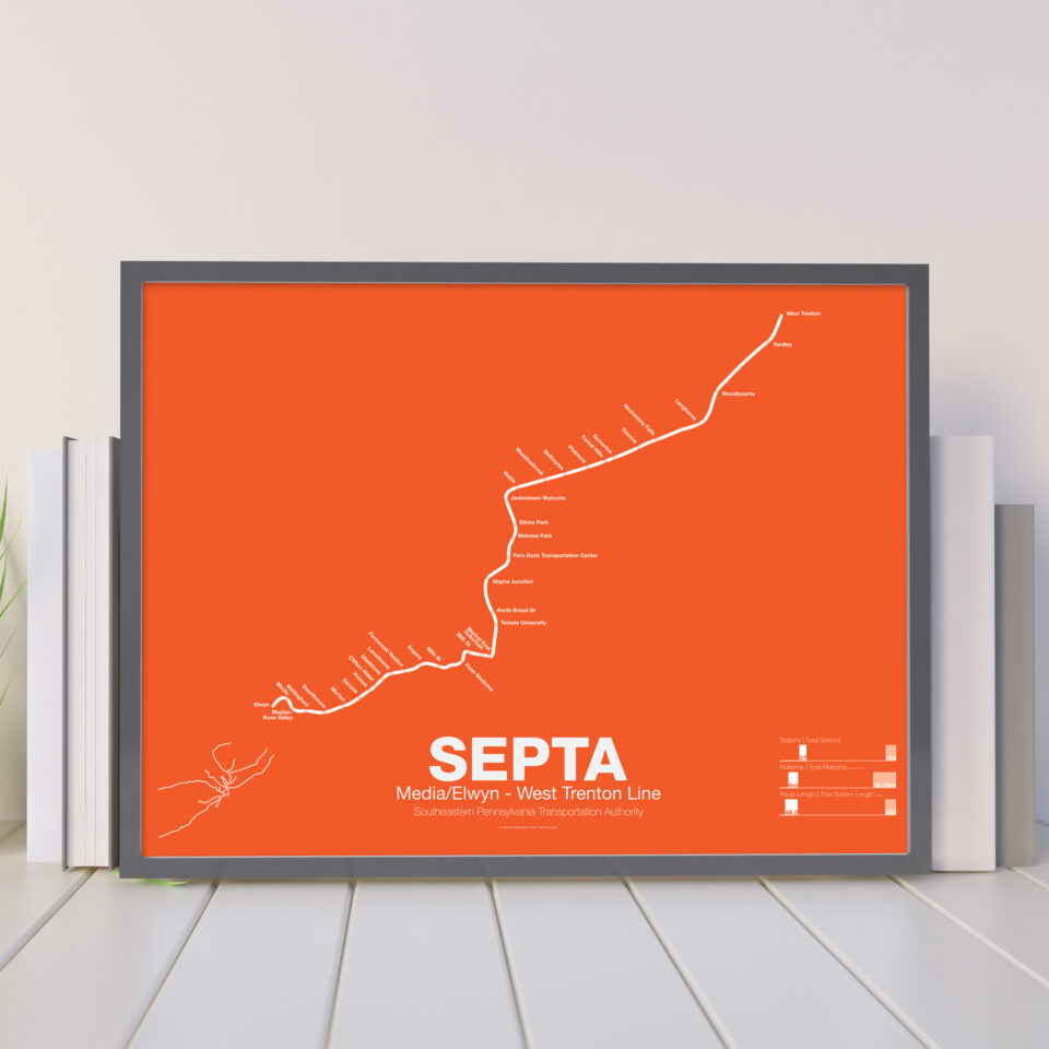
Working with GIS shape files while building subway maps, I noticed that many of the actual geographic routes produced interesting shapes. Many transit agencies have used simplified line maps on subway cars to indicate which stations are on a particular route. I developed Vanmaps with the intent of using the actual geographic routes on their own. I developed a poster concept that turned the line into an infographic, with an inset map showing how the line relates to the larger network, and three graphs showing how the data of the specific line stacks up to the whole.
Typical transit maps often distort geography to emphasize clarity in navigation. The design is often minimalist so that a user can clearly see the most important information. With Vanmaps, I flipped this concept. The lines are geographic, while the rest of the composition is minimalist. Even with this, the map is still useful as a tool.
Prints are available at my online store, www.vanmaps.com