Client
Washington Metropolitan Area Transit Authority (WMATA)
Project
In 2023, WMATA began to develop a pilot program for improving customer wayfinding throughout the system. The pilot centered around the L’Enfant Plaza station (near WMATA headquarters). The pilot aimed to improve how customers navigated the system through better signage and maps.
Signage
When a customer enters a station, either from the street or off a train, their first thought is “where do I go?” Washington D.C. is a city with a large tourism industry. A large section of riders on the WMATA system are not familiar with the network, and many do not speak English as their first language. The clean, modernist architecture of WMATA stations may have won awards, but the modular design means that each station looks the same; even locals can get lost. Signs, therefore, need to be clear as possible, both in language and in iconography, to serve all types of riders.
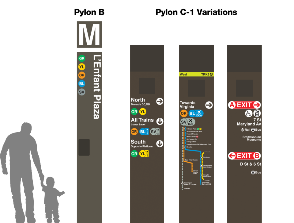
Pylons are placed at key locations throughout the station and direct riders to the exists, elevators, and transfer points. The pilot looked at ways to more clearly communicate where transfer points were, which lines went where, more clearly define the exits with new labels, and provide clearer route maps.
I experimented with changing the entrance pylons to more clearly indicate which trains served the station. I developed “tags” which could be added to service labels to indicate trains which went to local airports. I added directions to service labels like “Lower Level”, “Opposite Platform”, or “West to VA”, etc. These help riders understand which sides of the station they need to be at for their desired train, and how to navigate through the stations. Exist signs were improved with larger text, brighter colors, and more information about what was at each exit locations (bus, rail transfers, museums, etc).
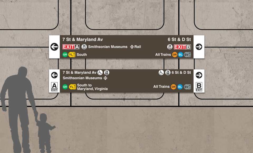
Wall signs are the first thing riders see when exiting a train. These signs are immensely important as, at this stage of navigation, customer anxiety can be high. Wall signs need to quickly grab a customers attention and give them the information they need as efficiently as possible. These signs don’t have to give a customer all the information they need, but they do need to direct them to the location of the next step, or next sign, which will further direct them to their desired destination.
Like with the pylons, I experimented with better labeled trains (including airport tags), exit labels, and elevator locations.
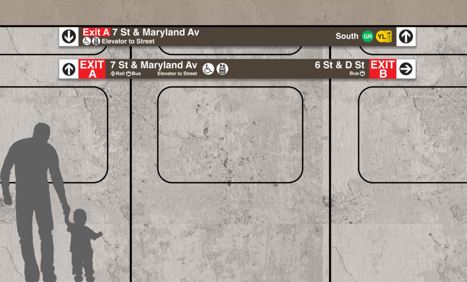
Similar to wall signs, ceiling signs are important for directing customers where the vertical clearance of a station (usually beneath a mezzanine) is lower. These signs need to condense more information into a smaller space. At these locations within the station, light levels are usually lower, and lines of sight may be blocked. It’s imperative that these signs are clear and visible so that customers can confidently continue their journey.
Neighborhood Map
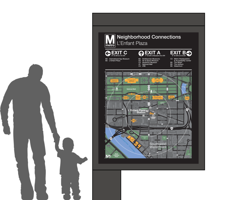
One of the goals of the wayfinding pilot was to better direct customers to their final destinations outside the system. Stations often include bus maps at their entrances for riders who are transferring between services, but these are often minimal in detail and focus only on bus routes.
An idea was to develop station specific maps that would direct a customer to local sites of interest based on standard walking distances. Bus lines would be included, but would be shown geographically. Since stations often have multiple entrance/exists, I organized these destinations based on their nearest entrance/exit to the station. A customer would see where they wanted to go, and understand which exit they needed to use to be closest to their ultimate destination.
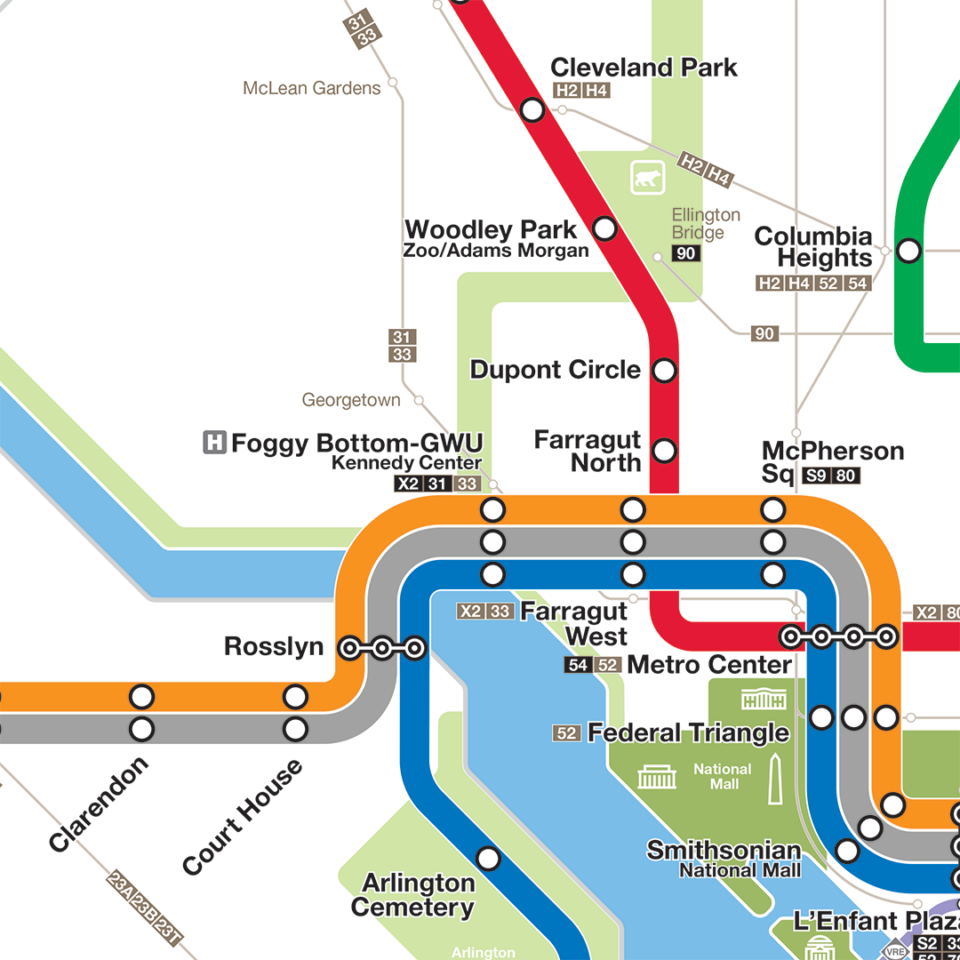
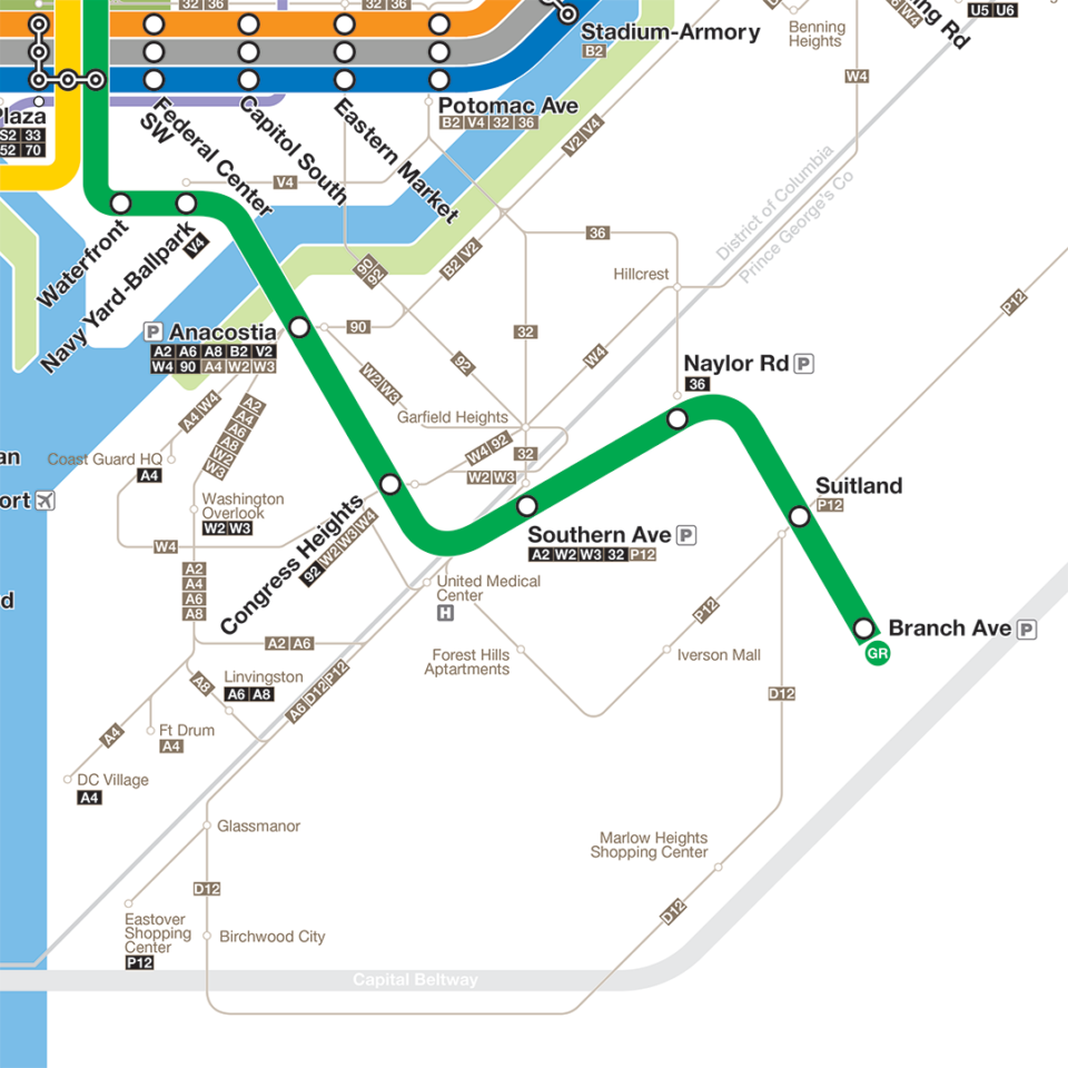
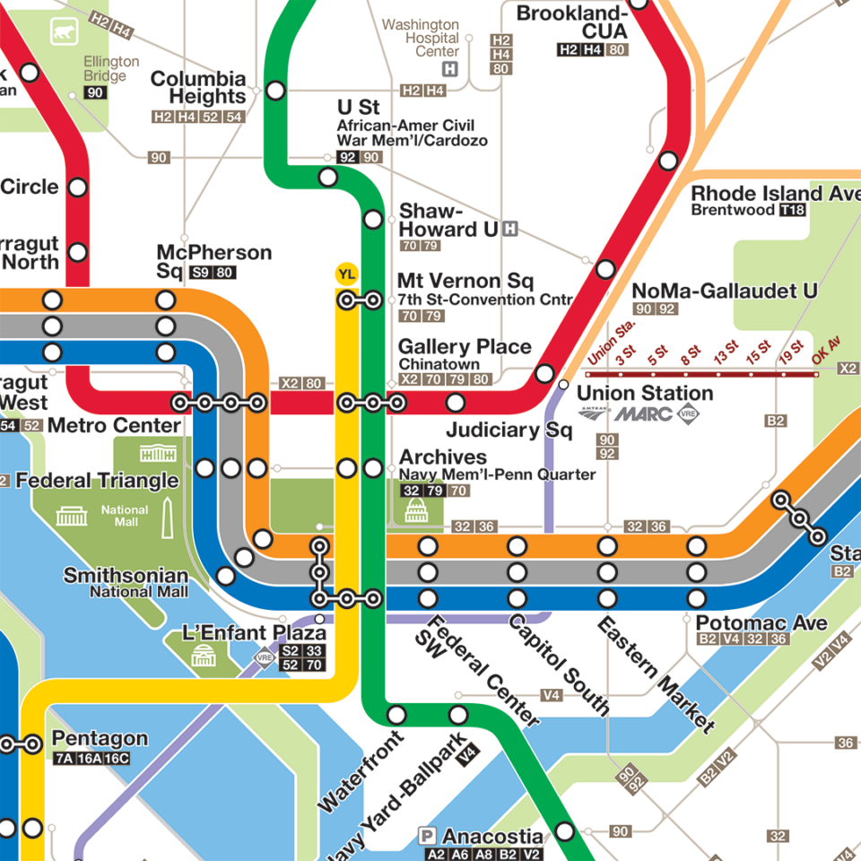
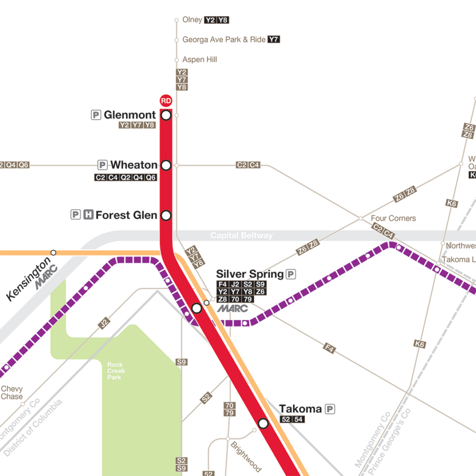
Intermodal System Map

Like many transit system maps, the WMATA map shows only the lines of the subway network. In reality, there are many more services which serve the metropolitan region, including local buses, commuter rail and long-distance rail, and light rail. The Intermodal Map was an attempt to combine all services into one map which better illustrated how a customer could navigate the city and region via all mass transit options.