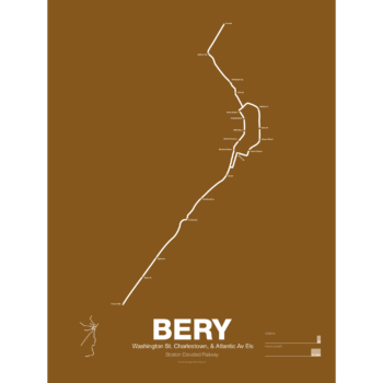
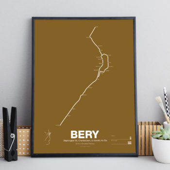
bery
-
 Price range: $30.00 through $80.00
What is today the Orange Line was part of the original Boston Elevated Railway subway and elevated network. Today the only section remaining is the Washington St Tunnel from Haymarket to Chinatown. Originally there were two lines through downtown: the Main Line and the Atlantic Ave El. The Main Line served elevated branches from Charlestown and along Washington St to Dudley Sq. in the South End. The Atlantic Ave El ran from Castle Sq. in the South End to North Station along Atlantic Ave to serve the maritime industries along the waterfront.
As the city grew so did the elevated lines, being extended to Forest Hills and Everett (a further extension to Malden was halted until the 1970s). As the maritime industry faded and ridership dropped the Atlantic Ave El was demolished and sold for scrap during World War II.
While the El served the city well it was not popular as it was loud, dark, and dirty. Plans were laid as early as 1945 to remove the El and rebuild as a subway.
In the 1970s the city canceled ambitious plans to run highways through and around the city and monies were transferred to subway construction. The northern section was rebuilt first, removing the elevated tracks through Charlestown and moving them west along a new subway to Malden in 1975.
The southern section was rebuilt along the route for the canceled I-95 expressway through Jamaica Plain to Forest Hills in 1987. While the new Orange Line was modern and fast the new route bypassed the existing community of Roxbury which relied heavily on mass transit. Service along the old route was replaced by the Silver Line bus in 2002.
Printed on Satin finish 80# cover stock – 220 GSM. Made in the USA! Standard production time is 5 Days. Please add more time for shipping.
Select options This product has multiple variants. The options may be chosen on the product page -
 Price range: $390.00 through $515.00
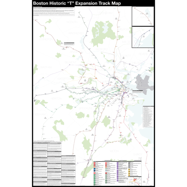
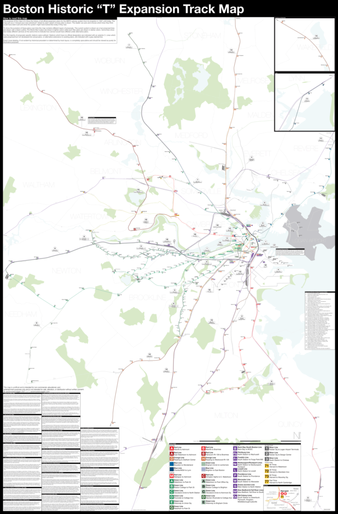
Boston opened the first subway in the US in 1897 and immediately began expanding it. Since then numerous plans have been drawn up, some are simple extensions while others are whole sale reimaginations of the subway. This map shows in detail each official proposal with the history of each idea.
The map acts as a “choose your own adventure” where by each variant of every plan is drawn. The reader can pick and choose which lines they think could have been built and what the system might have looked like today if they had.
Fine art prints are made in Williamsburg, Brooklyn NY on Semi-Gloss, 10mil Premium Luster Paper.
For more information about the map see the original blog post here.
Select options This product has multiple variants. The options may be chosen on the product page