Printed on Satin finish 80# cover stock – 220 GSM. Made in the USA! Standard production time is 5 Days. Please add more time for shipping.
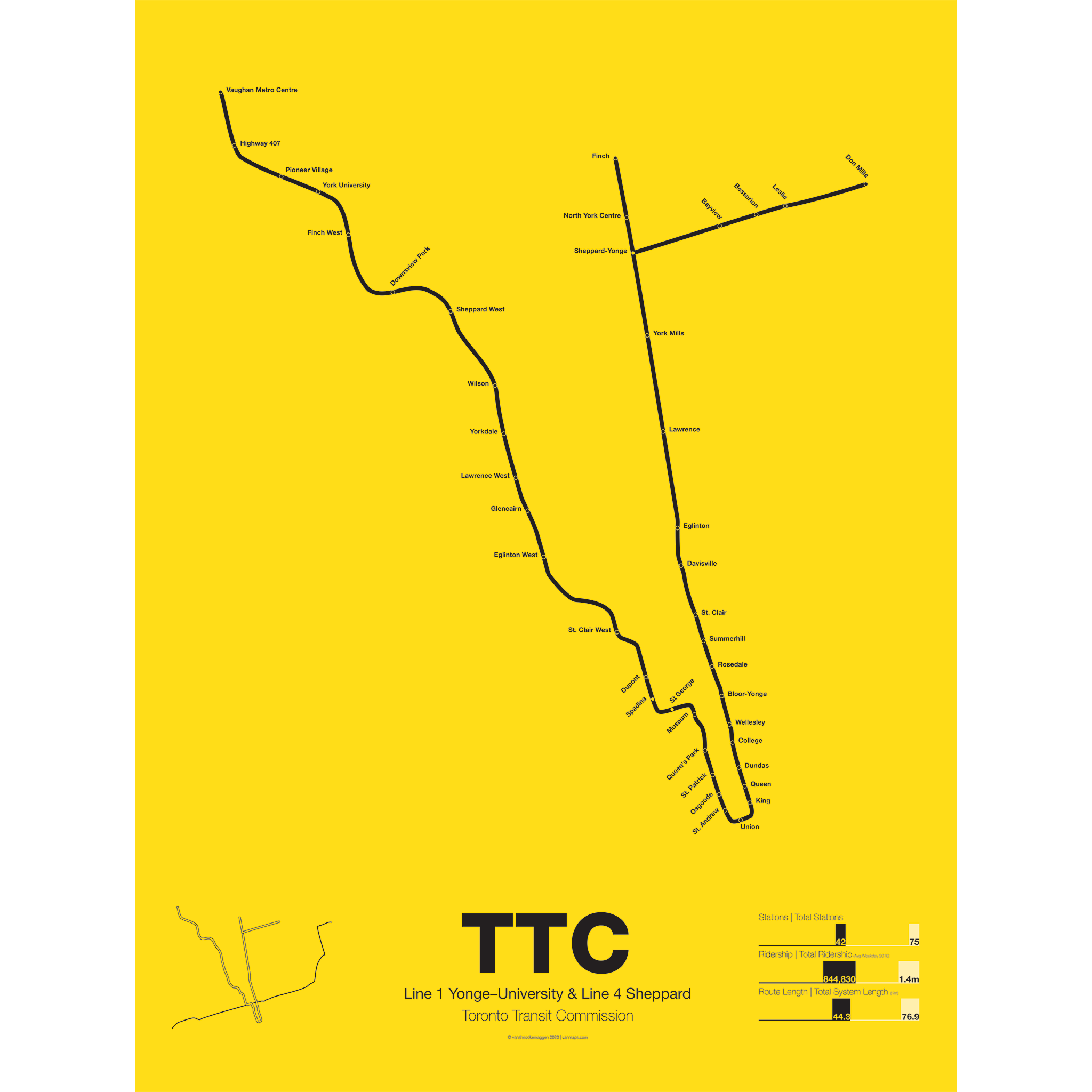
TTC Line 1 Yonge–University & Line 4 Sheppard Poster
Out of Stock$30.00 – $80.00
Additional information
| Weight | N/A |
|---|---|
| Dimensions | N/A |
| Size | Framed 18"x24", 18” x 24”, 24” x 36” |
Related products
-
 $30.00 – $80.00
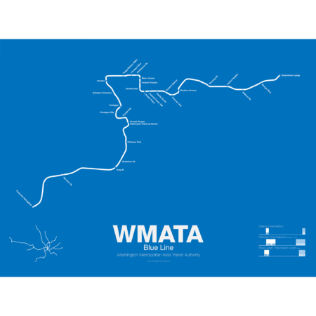
The Blue Line was the second section of the Washington Metro to open; on July 1st 1977 trains began running the familiar serpentine route from National Airport through Roslyn and Metro Center (at the time the only transfer station) to Stadium-Armory. In 1978 an extension to New Carrollton opened and service was split between Blue Line trains running from National Airport-New Carrollton and Orange Line trains running the reverse direction. When the Orange Line extension to Ballston opened a year later Blue Line trains were cut back to Stadium-Armory.
When the Addison Road branch opened in 1980 the Blue Line once again ran only one direction while Orange Line trains ran in the other direction, this time on both branches. In 1983 the Yellow Line was opened down to Huntington. This was originally to be the new terminal for Blue Line trains but due to a car shortage the Yellow Line, which required fewer cars, was extended instead, and this service pattern remains to this day. The extension to Van Dorn St (the originally planned terminal for the Yellow Line) didn’t open until 1991 and was extended to Franconia-Springfield in 1997. A final extension to Largo Town Center opened in 2004.
The Blue Line holds the distinction of the line which shares the most amount of track with other lines (the Orange and Yellow lines). In fact during rush hour service only the Arlington Cemetery station is served exclusively by Blue Line trains. Because of this, planners are looking at digging a new tunnel through central D.C. once the Silver Line opens which is also slated to share Blue Line tracks through downtown D.C.
Printed on Satin finish 80# cover stock – 220 GSM. Made in the USA! Standard production time is 5 Days. Please add more time for shipping.
Select options This product has multiple variants. The options may be chosen on the product page -
 $30.00 – $80.00
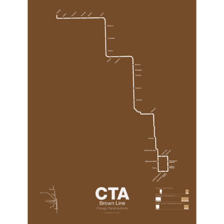
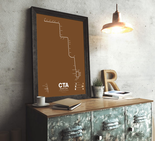
The Brown Line began as the Northwestern Elevated in 1907 and runs from its terminal at Kimball to the Loop and back, making a zig-zag through the northwest section of the city. At the terminal at Kimball trains run at street level with third-rail power which is rare for transit in the US and extremely dangerous for pedestrians. Brown Line trains run local with Red Line trains from Belmont to Fullerton. Recently the stations of the Brown Line were expanded and upgraded to be ADA compliant to deal with rapid population growth on the north side.
Printed on Satin finish 80# cover stock – 220 GSM. Made in the USA! Standard production time is 5 Days. Please add more time for shipping.
Select options This product has multiple variants. The options may be chosen on the product page -
 $30.00 – $80.00
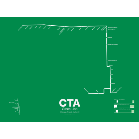
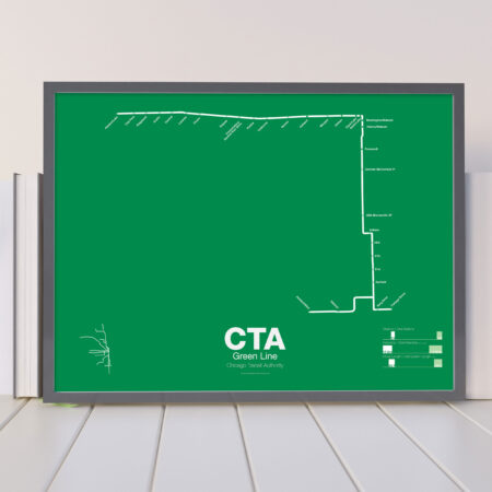
The Green Line is the modern combination of two of the oldest sections of the Chicago “L”. The South Side elevated opened in 1892 to serve the Columbian Exposition in 1893 and led to a building boom on the south side of Chicago. A number of branches were added to the line, to Englewood, Normal Park, Kenwood, and the Stock Yards. Today only the Englewood and Jackson Park branches remain while a number of stations have been closed due to low ridership.
The Lake St elevated was Chicago’s second elevated line opening in 1893. When the State St Subway opened in 1947 it was originally used by the South Side trains to connect to the north side and when the Dan Ryan Branch opened in 1969 it was used by the Lake St Line. In 1993 the CTA reorganized routings and color coded the new Lake St-South Side Lines as the Green Line.
Printed on Satin finish 80# cover stock – 220 GSM. Made in the USA! Standard production time is 5 Days. Please add more time for shipping.
Select options This product has multiple variants. The options may be chosen on the product page -
 $30.00 – $80.00
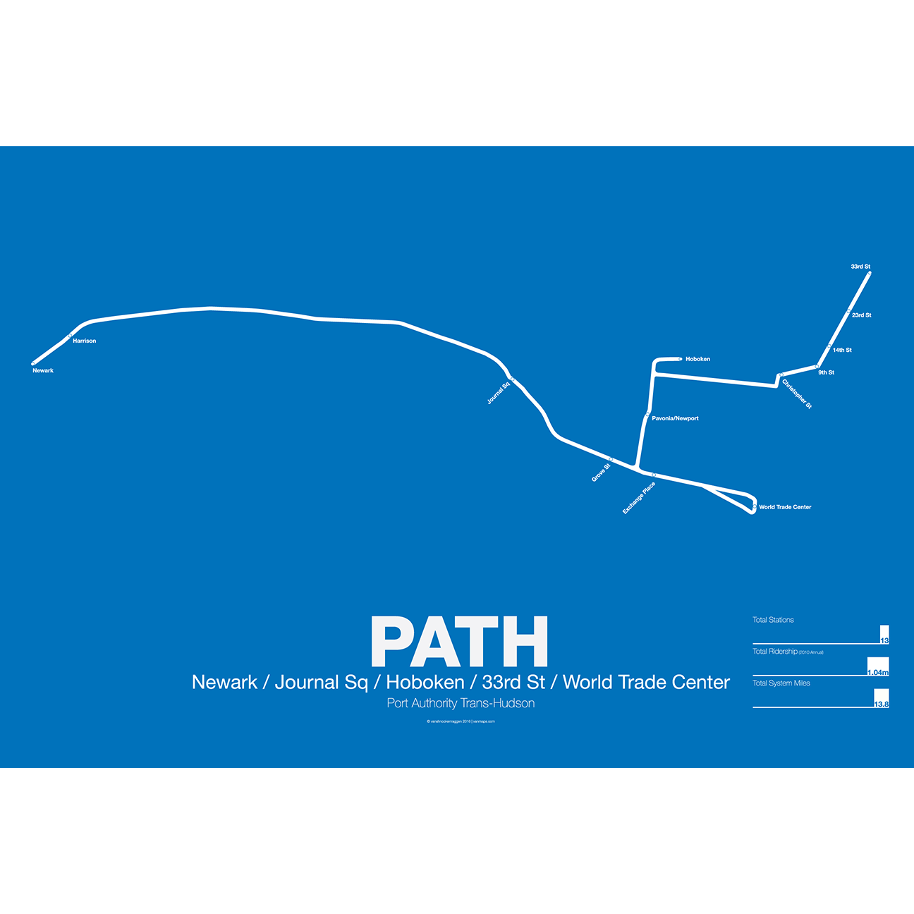
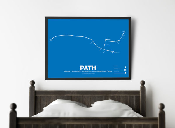
PATH (Port Authority Trans-Hudson), originally known as the Hudson and Manhattan Railroad (H&M), predates the original line of the NYC Subway. First planned in 1874, existing technologies could not safely tunnel under the Hudson River. Construction began on the existing tunnels in 1890, but stopped shortly thereafter when funding ran out. Construction did not resume until 1900 under the direction of William Gibbs McAdoo.
Opened in 1907, the Hudson and Manhattan Railroad tunnels were designed to link three of the major railroad terminals on the Hudson River in New Jersey—the Lackawanna in Hoboken, the Erie and PRR in Jersey City—with New York City. Two sets of tunnels connected commuters to the business centers in lower Manhattan and midtown Manhattan along 6th Ave. As the H&M was opened only 3 years after the original subway extensions were planned from 33rd St to Grand Central (original plans for Grand Central Terminal show space for a never built H&M station) and from 9th St to Astor Pl.
The H&M was only successful for a short 20 years as Pennsylvania Station opened in midtown in 1910 and the Holland Tunnel opened in 1927, diverting rail traffic from New Jersey terminals and then by commuters who chose to drive. Two original stations at 19th St and 28th St were closed to speed up service. By the 1950s the railroad was in bankruptcy but continued to operate. In 1961 the Port Authority was tapped to construct a new World Trade Center in lower Manhattan. In a deal with the states of New York and New Jersey the Port Authority agreed to take over the railroad and moved the location of the new WTC to the Hudson Terminal of the H&M in lower Manhattan. The Port Authority upgraded the system and changed the name to PATH.
Printed on Satin finish 80# cover stock – 220 GSM. Made in the USA! Standard production time is 5 Days. Please add more time for shipping.
Select options This product has multiple variants. The options may be chosen on the product page

Reviews
There are no reviews yet.