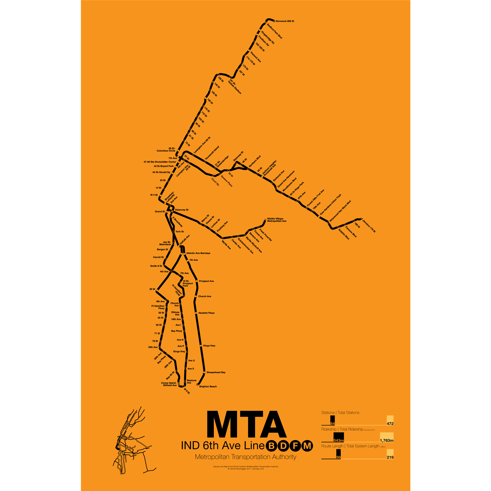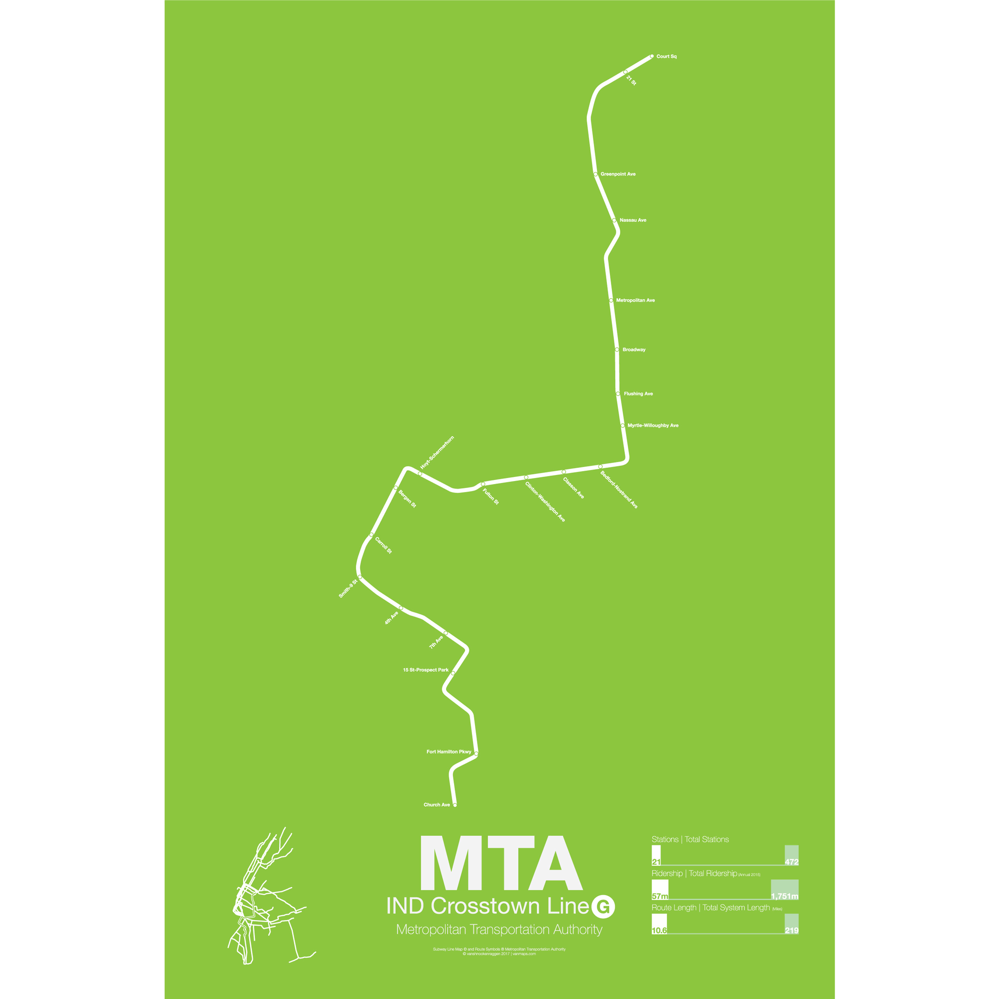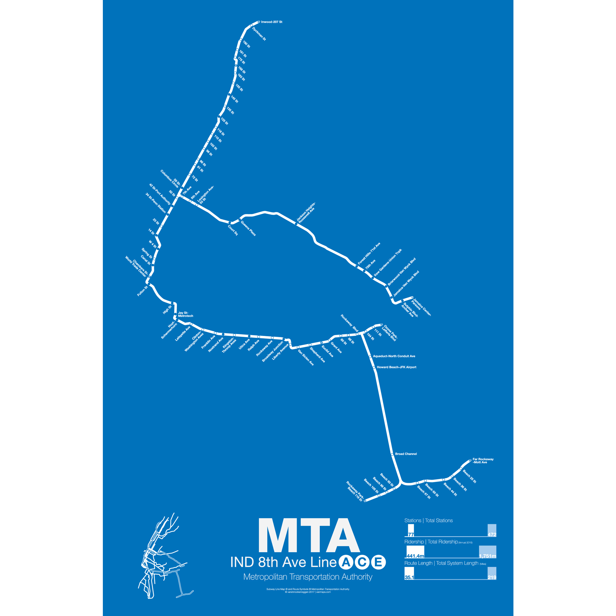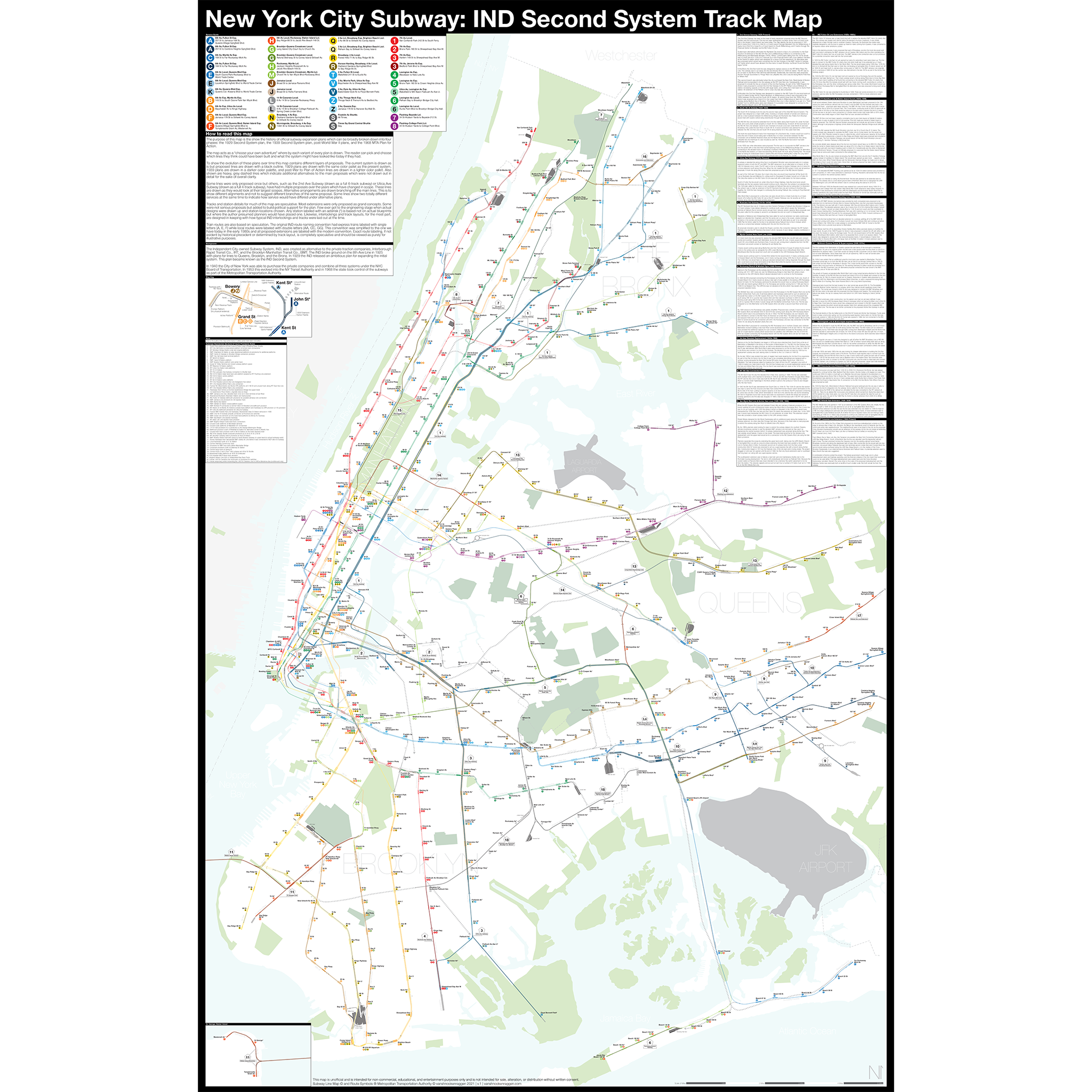
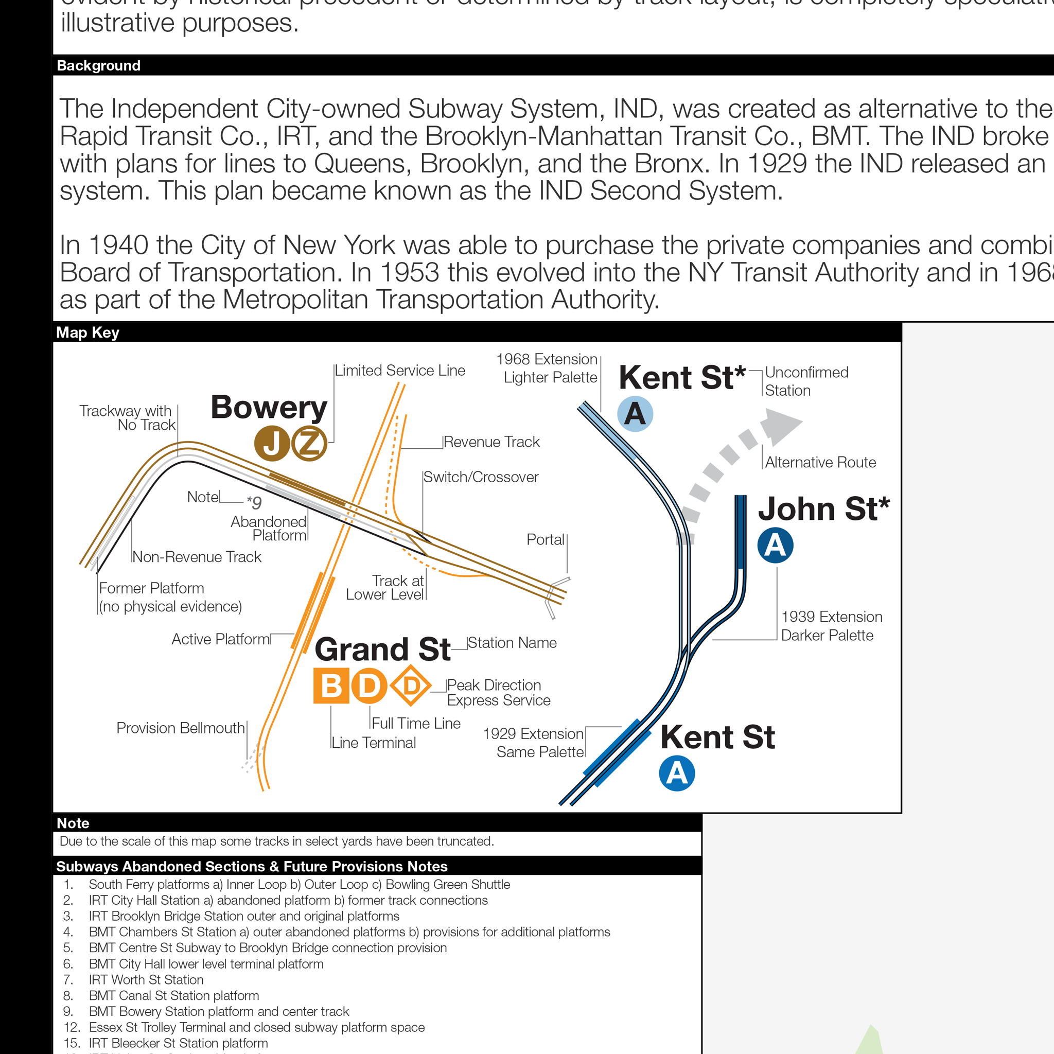
The Independent City-owned Subway System, IND, was created as alternative to the private traction companies, Interborough Rapid Transit Co., IRT, and the Brooklyn-Manhattan Transit Co., BMT. The IND broke ground on the 8th Ave Line in 1925 with plans for lines to Queens, Brooklyn, and the Bronx. In 1929 the IND released an ambitious plan for expanding the initial system. This plan became known as the IND Second System. In 1940 the City of New York was able to purchase the private companies and combine all three systems under the NYC Board of Transportation. In 1953 this evolved into the NY Transit Authority and in 1968 the state took control of the subways as part of the Metropolitan Transportation Authority.
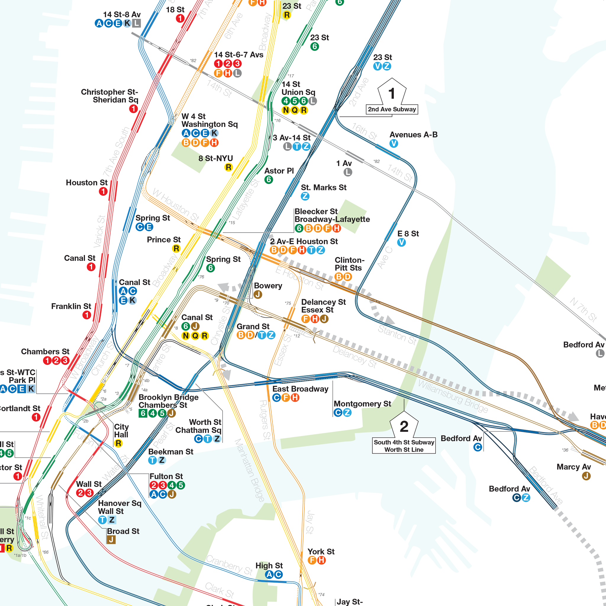
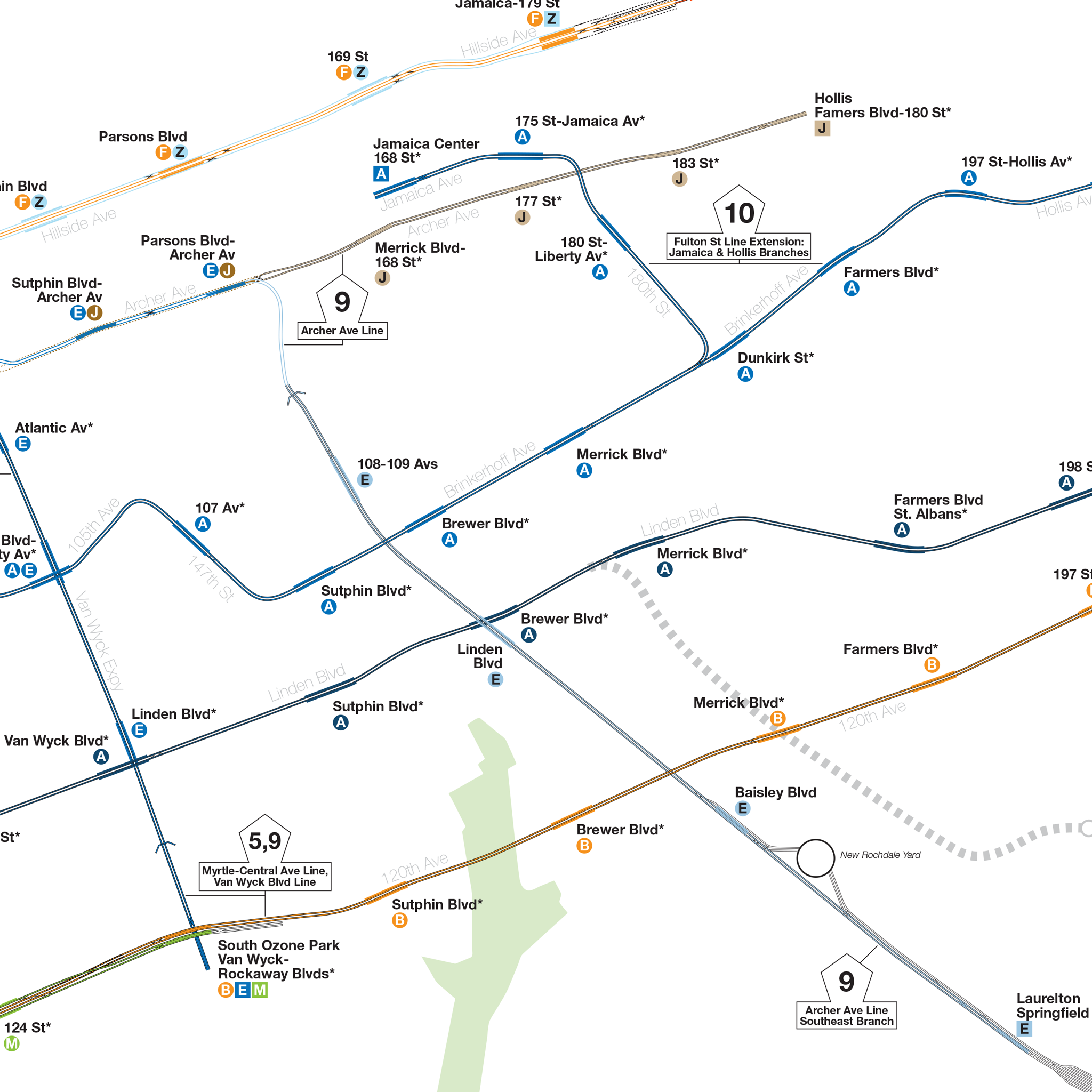
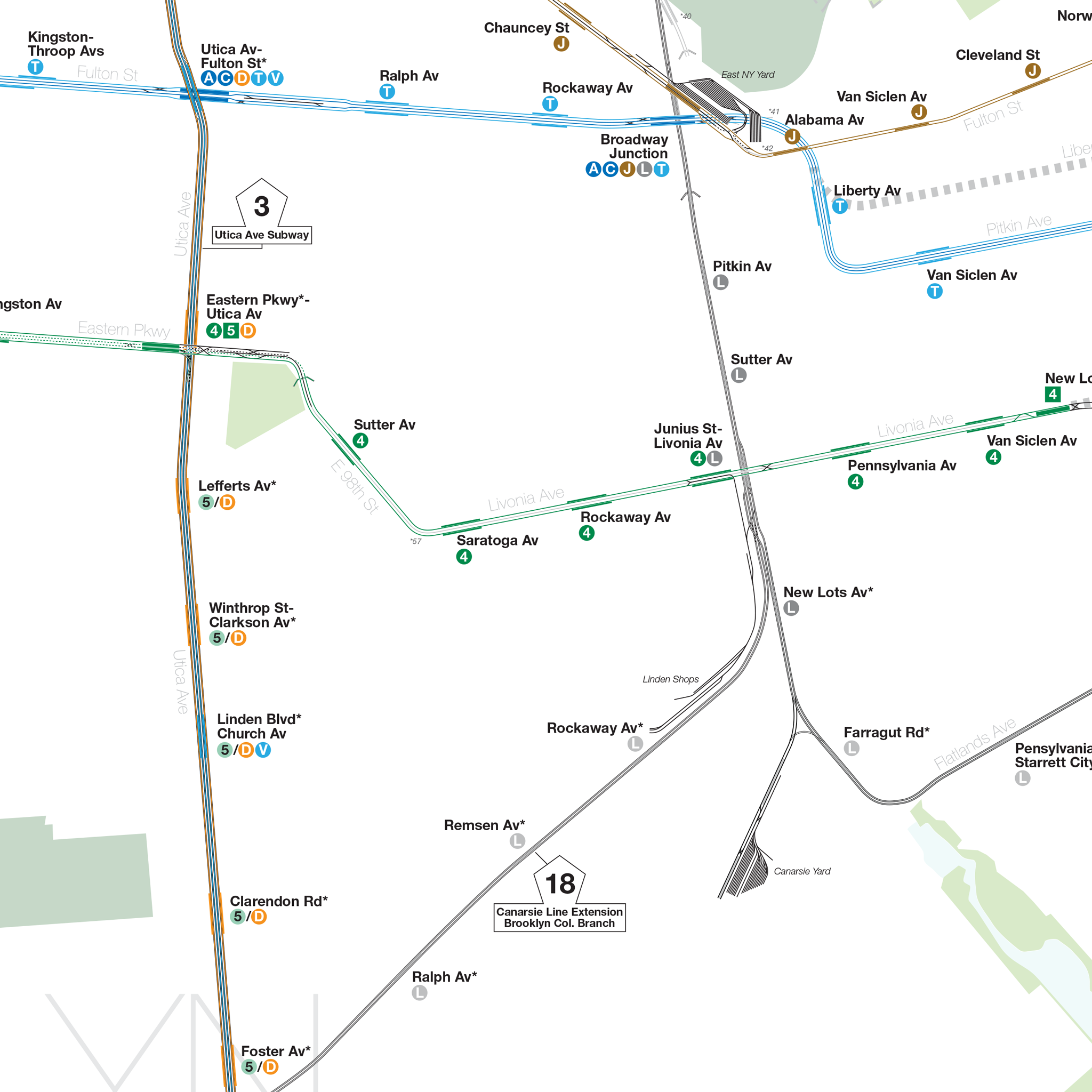
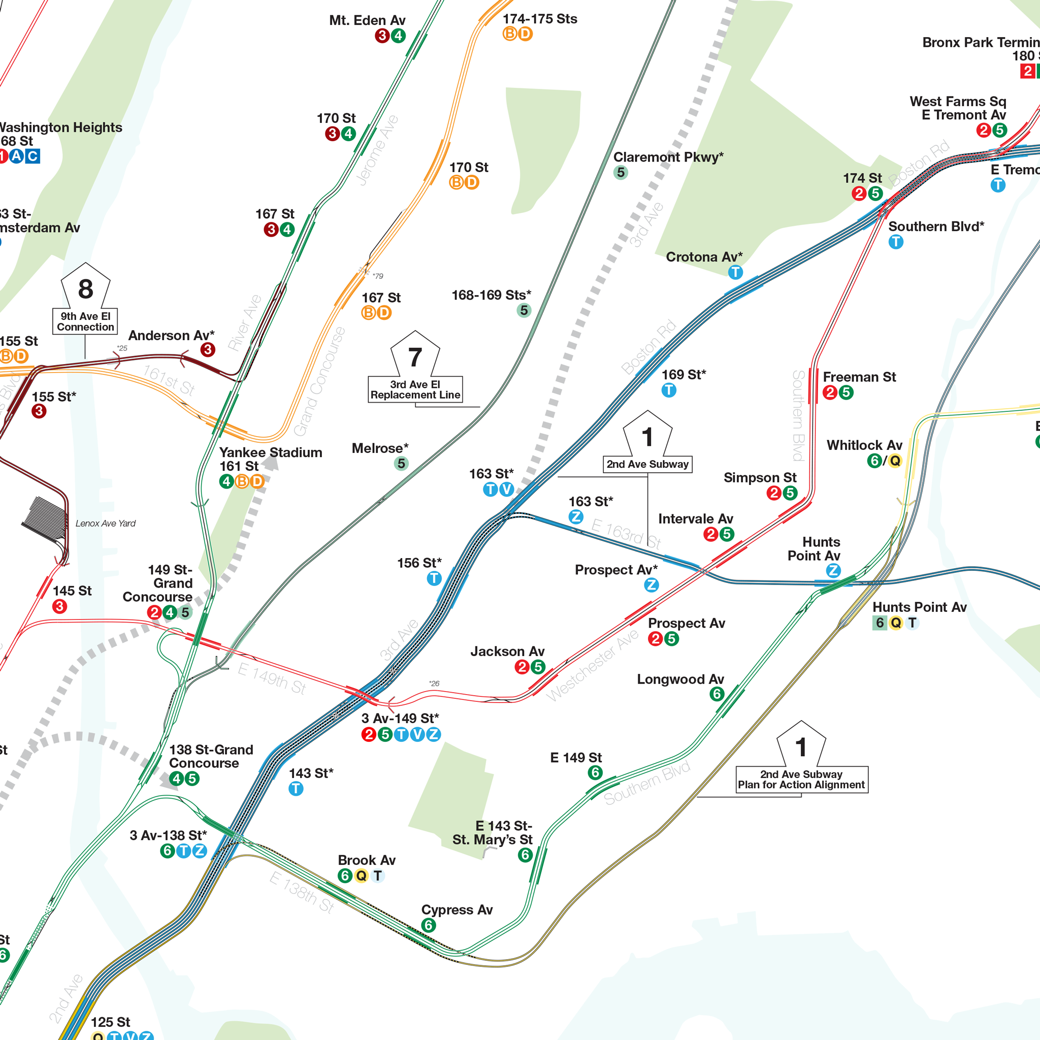
The purpose of this map is the show the history of official subway expansion plans which can be broadly broken down into four phases: the 1929 Second System plan, the 1939 Second System plan, post-World War II plans, and the 1968 MTA Plan for Action.
The map acts as a “choose your own adventure” where by each variant of every plan is drawn. The reader can pick and choose which lines they think could have been built and what the system might have looked like today if they had.
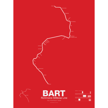
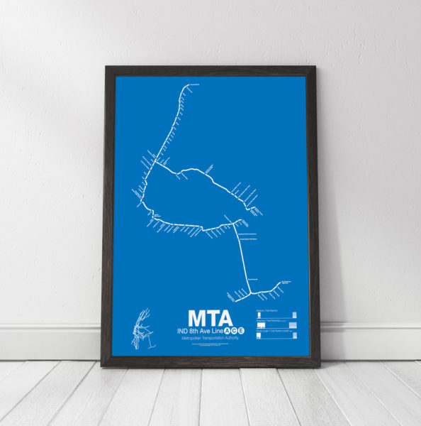
Fine art prints are made in Williamsburg, Brooklyn NY on Semi-Gloss, 10mil Premium Luster Paper.
For more information about the map see the original blog post here.