poster
106 Products
Active Filters
Filter by Category
Filter by Color
Filter by Price
Min Price:
Max Price:
-
 $30.00 – $80.00
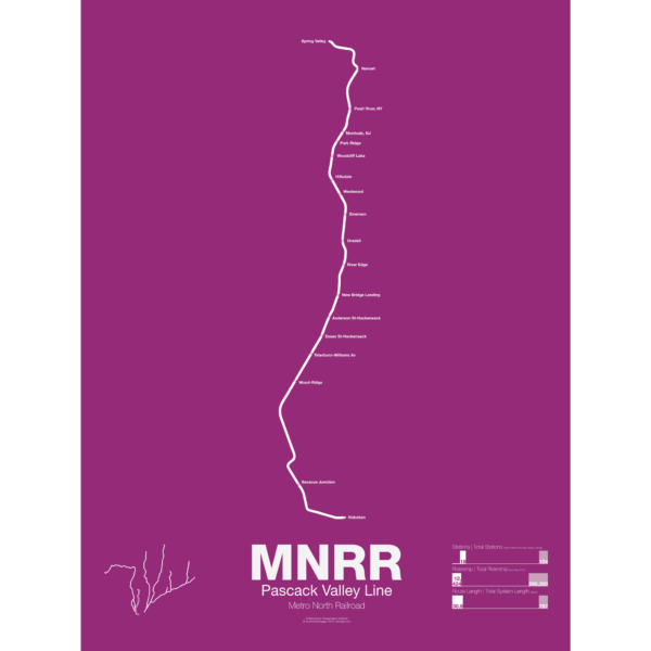
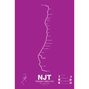
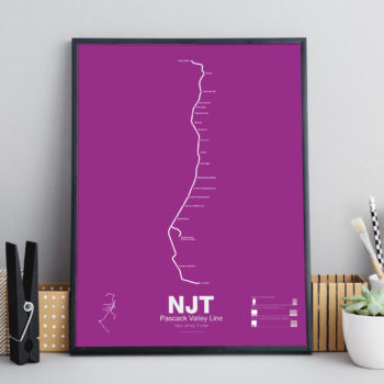
The Metro North Pascack Valley Line is a mostly single tracked line running from Spring Valley, NY through northern New Jersey to Hoboken Terminal. Pascack Valley is one of two Metro North lines which run through New Jersey (the other being the Port Jervis Line) but unlike the Port Jervis Line which is owned by Metro North in New York, the Pascack Valley Line is entirely owned by New Jersey Transit and the stations in New York are leased to Metro North. The line was originally chartered in 1856 and was bought by the Erie Railroad in 1896. New Jersey Transit and Metro North took over in 1983.
Printed on Satin finish 80# cover stock – 220 GSM. Made in the USA! Standard production time is 5 days. Allow more time for shipping.
Select options This product has multiple variants. The options may be chosen on the product page -

 $30.00 – $80.00
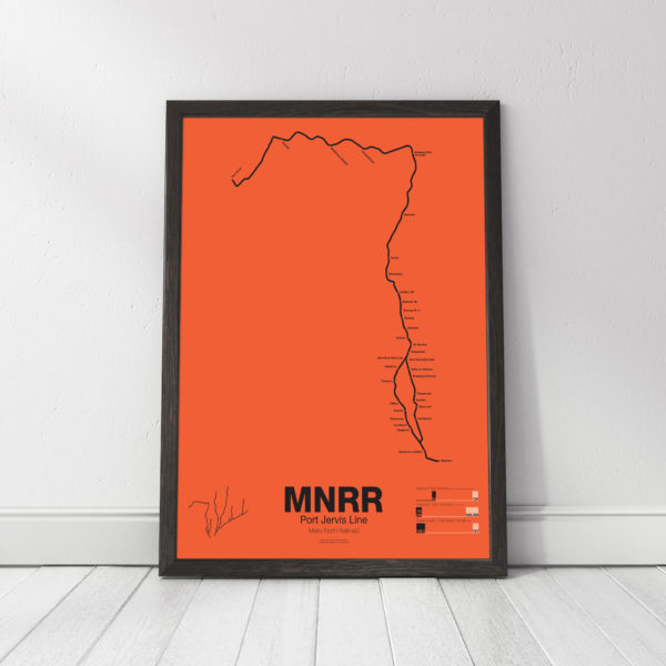
The Metro North Port Jervis Line runs from Port Jervis where Pennsylvania, New Jersey and New York meet, through Sullivan and Rockland Counties, NY, and then through northern New Jersey to the Hoboken Terminal in Hoboken, NJ. Much of the Port Jervis Line started as the New York and Erie Railroad Main Line, opening to Port Jervis in 1848. The original line ran through the towns of Monroe, Chester, Goshen, and Middletown but this stretch was abandoned in 1984 when Metro North chose to move service to a longer, but faster and straighter, route.
The Erie Main Line once reached Buffalo and Chicago via the Southern Tier of New York State but lost money and ridership after World War II. The Port Jervis Line is one of two Metro North lines which run through New Jersey. The tracks in New York are owned and operated by Metro North but the tracks in New Jersey are owned and operated by New Jersey Transit. Port Jervis trains run to Hoboken Terminal but transfers are available at Secaucus Junction for service to Penn Station.
Printed on Satin finish 80# cover stock – 220 GSM. Made in the USA! Standard production time is 5 days. Allow more time for shipping.
Select options This product has multiple variants. The options may be chosen on the product page -
 $45.00
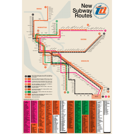
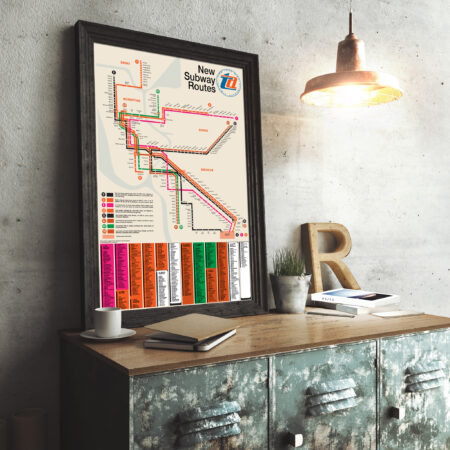
“I defy anyone to take this psychedelic creation and figure out how to get anywhere!” -State Senator Albert B. Lewis 1967.
The Chrystie Street Connection didn’t just revolutionize how commuters got around by creating new subway lines but it also helped usher in a new era of modernist wayfinding and system maps. Chrystie St took a decade to build and knit together the once separate BMT and IND subway systems to create a new network which we still use today. This map was part of a brochure issued when the first new lines were opening in November 1967. This map was the first to introduce the idea that each line would be shown with its own color and lettered bullet, simplifying naming conventions. For a further look at the Chrystie St Connection check out my blog post!
This map has been carefully recreated down to the exact typeface. Included at the bottom was the reverse side of the original brochure, featuring a station by station listing of each new line. Printed on Satin finish 80# cover stock – 220 GSM, 24″ x 36″.
-
 $30.00 – $80.00
Printed on Satin finish 80# cover stock – 220 GSM. Made in the USA! Standard production time is 5 days. Allow more time for shipping.
Select options This product has multiple variants. The options may be chosen on the product page -
 $30.00 – $80.00
Printed on Satin finish 80# cover stock – 220 GSM. Made in the USA! Standard production time is 5 days. Allow more time for shipping.
Select options This product has multiple variants. The options may be chosen on the product page -
 $30.00 – $80.00
Printed on Satin finish 80# cover stock – 220 GSM. Made in the USA! Standard production time is 5 days. Allow more time for shipping.
Select options This product has multiple variants. The options may be chosen on the product page -
 $30.00 – $80.00
Printed on Satin finish 80# cover stock – 220 GSM. Made in the USA! Standard production time is 5 days. Allow more time for shipping.
Select options This product has multiple variants. The options may be chosen on the product page -
 $30.00 – $80.00
Printed on Satin finish 80# cover stock – 220 GSM. Made in the USA! Standard production time is 5 days. Allow more time for shipping.
Select options This product has multiple variants. The options may be chosen on the product page -
 $30.00 – $80.00
Printed on Satin finish 80# cover stock – 220 GSM. Made in the USA! Standard production time is 5 days. Allow more time for shipping.
Select options This product has multiple variants. The options may be chosen on the product page -
 $30.00 – $80.00
Printed on Satin finish 80# cover stock – 220 GSM. Made in the USA! Standard production time is 5 days. Allow more time for shipping.
Select options This product has multiple variants. The options may be chosen on the product page -
 $30.00 – $80.00
Printed on Satin finish 80# cover stock – 220 GSM. Made in the USA! Standard production time is 5 days. Allow more time for shipping.
Select options This product has multiple variants. The options may be chosen on the product page -
 $30.00 – $80.00
Printed on Satin finish 80# cover stock – 220 GSM. Made in the USA! Standard production time is 5 days. Allow more time for shipping.
Select options This product has multiple variants. The options may be chosen on the product page -
 $30.00 – $80.00
Printed on Satin finish 80# cover stock – 220 GSM. Made in the USA! Standard production time is 5 days. Allow more time for shipping.
Select options This product has multiple variants. The options may be chosen on the product page -
 $30.00 – $80.00
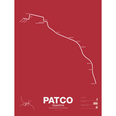
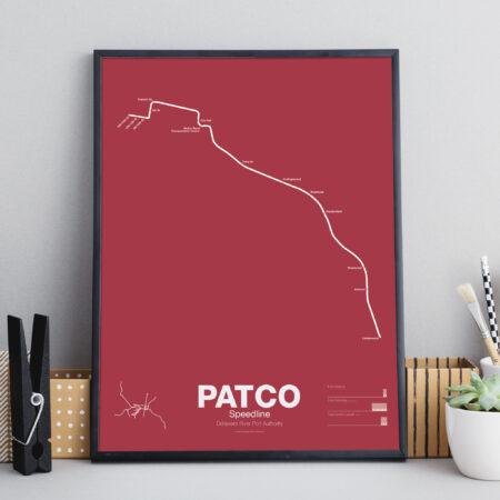
PATCO (Port Authority Transit Corp) is owned by the Delaware River Port Authority (DRPA), a separate authority than SEPTA. The line began as a simple 4 station shuttle over the newly opened Benjamin Franklin Bridge in 1936. The line ran from 8th St and Franklin Sq in Philadelphia and Broadway in Camden, NJ. On the Philly side the line connected to a tunnel which had been built for a proposed subway loop around Center City but the loop idea had been shelved after construction started. The Broad-Ridge Spur used the tunnel to reach 16th St-Locust but originally the PATCO trains terminated at 8th and Market. In 1968 the connection was rebuilt so that Broad-Ridge trains terminated at 8th St and PATCO trains were extended to 15th-16th station. This section of tunnel is still owned by SEPTA and is leased to PATCO.
On the New Jersey side PATCO had been little more than a shuttle which required suburban commuters to transfer to continue their journey. In 1951 DRPA commissioned a study which recommended 3 different branches, one to Moorestown, one to Kirkland, and one to Woodbury Heights. A later study suggested that the Kirkland route offered the most potential ridership and so PATCO was extended to Lindenwood station in 1969. PATCO continues to study expansions and has looked into extended a branch to Glassboro as well. There is an abandoned station at Franklin Sq which sees requests now and then for reactivation but PATCO claims that it wouldn’t receive high enough ridership (the area around the square was razed in the 1970s to build the Vine St and Delaware Expressways interchange.
Printed on Satin finish 80# cover stock – 220 GSM. Made in the USA! Standard production time is 5 days. Allow more time for shipping.
Select options This product has multiple variants. The options may be chosen on the product page -
 $30.00 – $80.00
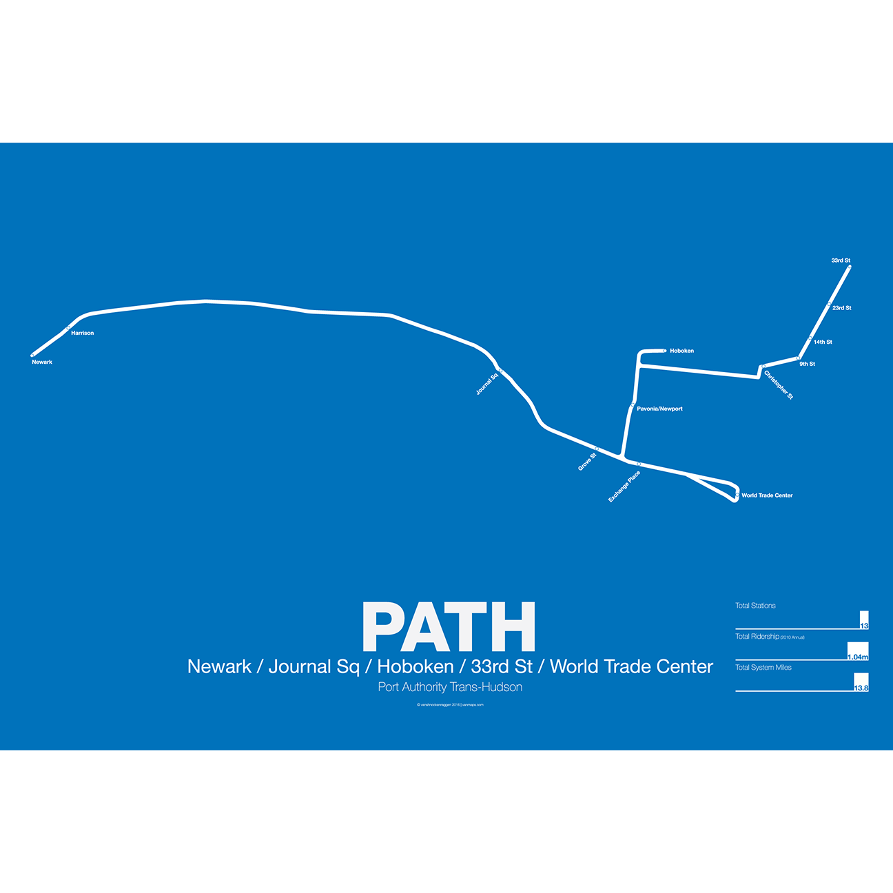
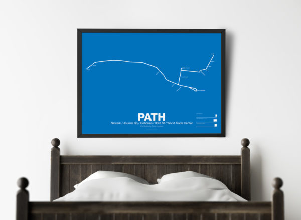
PATH (Port Authority Trans-Hudson), originally known as the Hudson and Manhattan Railroad (H&M), predates the original line of the NYC Subway. First planned in 1874, existing technologies could not safely tunnel under the Hudson River. Construction began on the existing tunnels in 1890, but stopped shortly thereafter when funding ran out. Construction did not resume until 1900 under the direction of William Gibbs McAdoo.
Opened in 1907, the Hudson and Manhattan Railroad tunnels were designed to link three of the major railroad terminals on the Hudson River in New Jersey—the Lackawanna in Hoboken, the Erie and PRR in Jersey City—with New York City. Two sets of tunnels connected commuters to the business centers in lower Manhattan and midtown Manhattan along 6th Ave. As the H&M was opened only 3 years after the original subway extensions were planned from 33rd St to Grand Central (original plans for Grand Central Terminal show space for a never built H&M station) and from 9th St to Astor Pl.
The H&M was only successful for a short 20 years as Pennsylvania Station opened in midtown in 1910 and the Holland Tunnel opened in 1927, diverting rail traffic from New Jersey terminals and then by commuters who chose to drive. Two original stations at 19th St and 28th St were closed to speed up service. By the 1950s the railroad was in bankruptcy but continued to operate. In 1961 the Port Authority was tapped to construct a new World Trade Center in lower Manhattan. In a deal with the states of New York and New Jersey the Port Authority agreed to take over the railroad and moved the location of the new WTC to the Hudson Terminal of the H&M in lower Manhattan. The Port Authority upgraded the system and changed the name to PATH.
Printed on Satin finish 80# cover stock – 220 GSM. Made in the USA! Standard production time is 5 Days. Please add more time for shipping.
Select options This product has multiple variants. The options may be chosen on the product page -
 $30.00 – $80.00
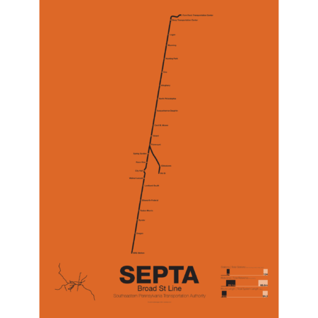
The Broad Street subway line was opened in 1928 from Olney Ave to City Hall with subsequent extensions south to Walnut-Locust, Lombard-South, Sunder Ave, Pattison Ave (now AT&T) and finally Fern Rock over the next years and decades. Broad St was envisioned as part of a larger subway network and was to be a trunk line for multiple suburban branches, none of which have been built (the most famous is the still proposed Roosevelt Boulevard Subway). The line was built with 4 tracks, two local and two express, and junctions were built for the future branches, the only one built being the Ridge Ave Spur which has been converted for use by PATCO trains. Broad St runs four different services: B1 local, B2 express, B3 Ridge Ave Spur, and special event trains for games at the NRG sports complex.
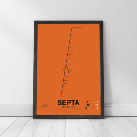
The SEPTA Broad St Line poster shows the line with local and express stations, along with statistics and a mini map showing the line as part of the overall SEPTA network.
Printed on Satin finish 80# cover stock – 220 GSM. Made in the USA! Standard production time is 5 days. Allow more time for shipping.
Select options This product has multiple variants. The options may be chosen on the product page

