-
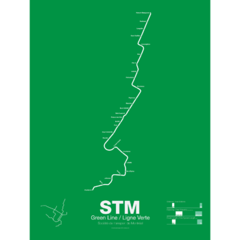
 Price range: $30.00 through $80.00
Printed on Satin finish 80# cover stock – 220 GSM. Made in the USA! Standard production time is 5 days. Allow more time for shipping.
Select options This product has multiple variants. The options may be chosen on the product page -
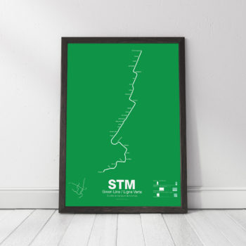
 Price range: $30.00 through $80.00
Printed on Satin finish 80# cover stock – 220 GSM. Made in the USA! Standard production time is 5 days. Allow more time for shipping.
Select options This product has multiple variants. The options may be chosen on the product page -
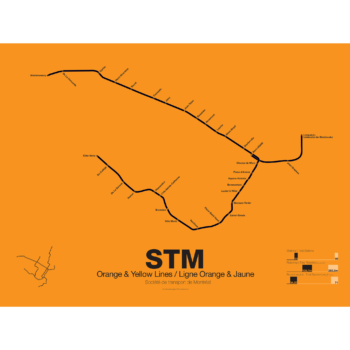
 Price range: $30.00 through $80.00
Printed on Satin finish 80# cover stock – 220 GSM. Made in the USA! Standard production time is 5 days. Allow more time for shipping.
Select options This product has multiple variants. The options may be chosen on the product page -
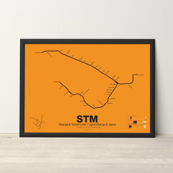
 Price range: $30.00 through $80.00
Printed on Satin finish 80# cover stock – 220 GSM. Made in the USA! Standard production time is 5 days. Allow more time for shipping.
Select options This product has multiple variants. The options may be chosen on the product page -
 Price range: $30.00 through $80.00
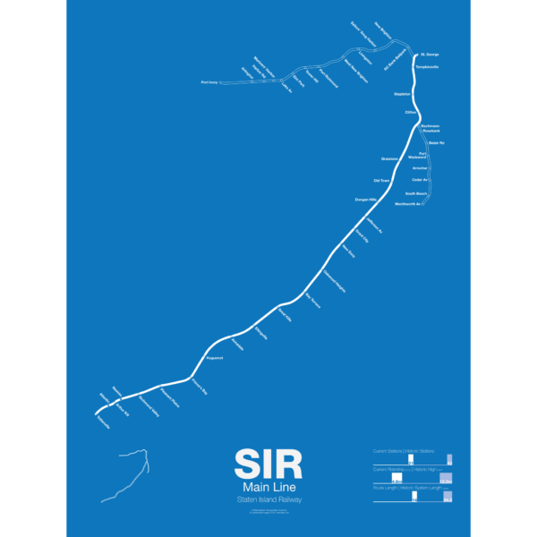
The Staten Island Railway was founded in 1851 as a way to connect the island to Cornelius Vanderbilt’s ferry to Manhattan. It was expanded in the 1880s with a North Shore Branch which connected the island to New Jersey and a South Beach Branch which ran past Fort Wadsworth to the beaches on the islands southeastern shore. The railroad served both passenger and freight traffic. In the 1920s the railroad was electrified in anticipation of a connection to the subway in Brooklyn but the tunnel was never built. After World War II ridership dropped as more residents chose to drive or take cheaper buses over the new bridges to New Jersey. Service on the North Shore and South Beach Branches was ended in 1953, though the North Shore Branch was (and still partially is) still used for freight. Plans have been floated to reactive the North Shore Branch as rail or bus rapid transit but so far nothing has been done.
This poster shows the existing Main Line and two former branches, the North Shore Branch to Port Ivory and the South Beach Branch to Wentworth Ave.
Printed on Satin finish 80# cover stock – 220 GSM. Made in the USA! Standard production time is 5 days. Allow more time for shipping.
Select options This product has multiple variants. The options may be chosen on the product page -
 Price range: $30.00 through $80.00
Printed on Satin finish 80# cover stock – 220 GSM. Made in the USA! Standard production time is 5 Days. Please add more time for shipping.
Select options This product has multiple variants. The options may be chosen on the product page -
 Price range: $30.00 through $80.00
Printed on Satin finish 80# cover stock – 220 GSM. Made in the USA! Standard production time is 5 Days. Please add more time for shipping.
Select options This product has multiple variants. The options may be chosen on the product page -
 Price range: $30.00 through $80.00
Printed on Satin finish 80# cover stock – 220 GSM. Made in the USA! Standard production time is 5 Days. Please add more time for shipping.
Select options This product has multiple variants. The options may be chosen on the product page -
 $45.00
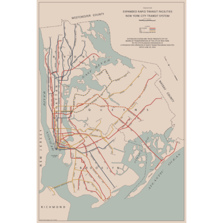
There are two “official” maps of the IND Subway’s expansion plans from the 1930s, colloquially known as the Second System. The plans for expansion evolved greatly as the IND was built. In the 1930s, the New York City subways were still operated by three separate companies. In 1940 the two private companies, the IRT and BMT were purchased by the City of New York under a unification plan. Thus, subway planners were able to imagine physically combining the three systems.
In 1940, John Delaney, Chairman of the Board of Transportation, outlined a new plan, with some additions in 1943. Until now, there were no maps of this plan. So I made one! The 1943 Lost IND Second System Map is probably the last time the city thought about such a large expansion program. The map here is based on the design of the 1939 map, with some changes.
To learn more about the history of this map, and see an outline of the ideas it shows, check out my post.
Printed on Satin finish 80# cover stock – 220 GSM, 24″ x 36″.
-
 Price range: $30.00 through $80.00
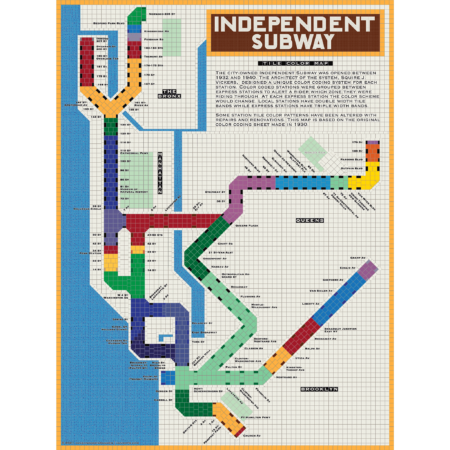
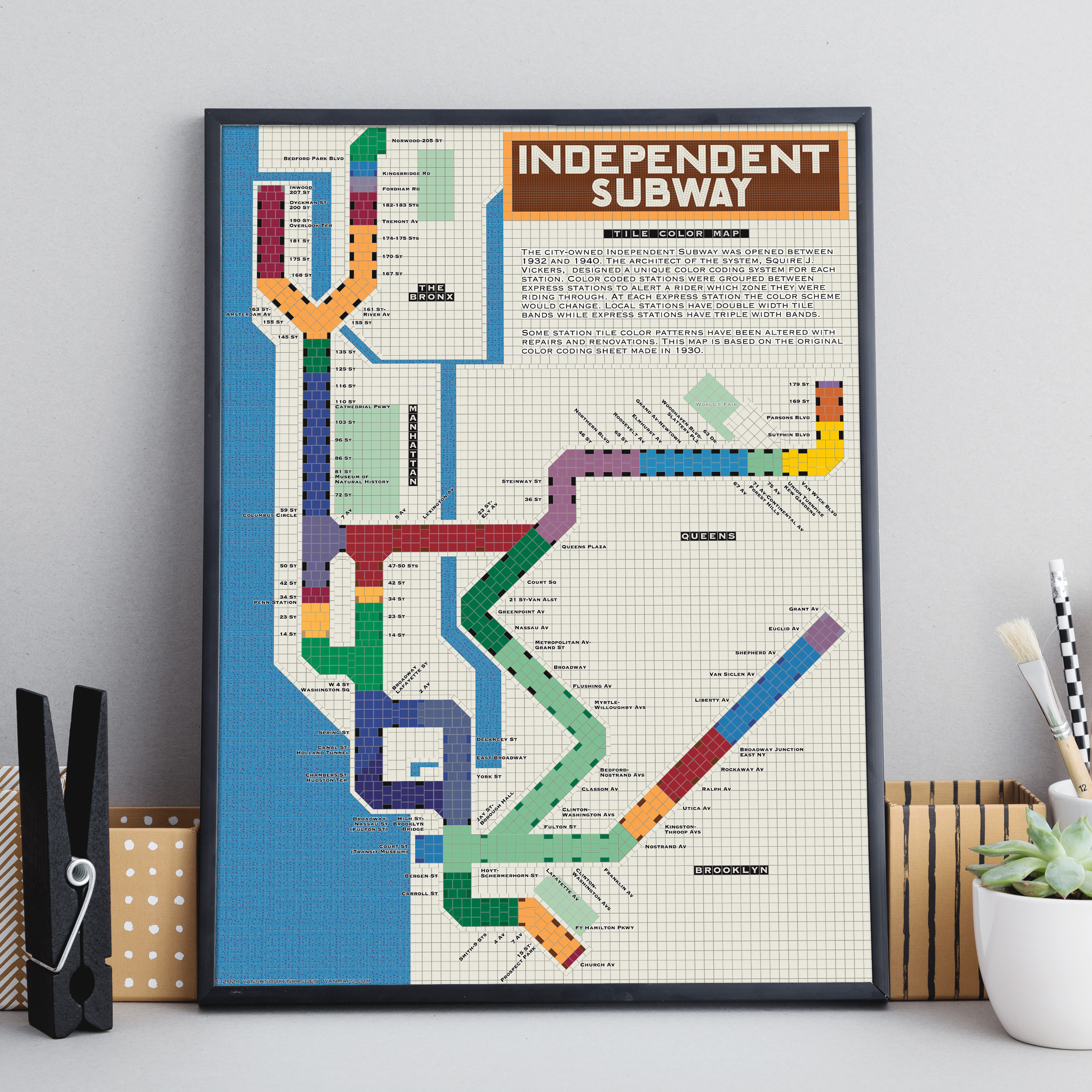
The City of New York built Independent Subway (A/B/C/D/E/F/G trains) was opened between 1932 and 1940. All the subway stations at the time featured tile bands and art unique to each station. The IND’s architect, Squire Vickers, created a new tile pattern based on color theory. He grouped express and local stations with color so that each time a rider rode through an express station the color of the tiles would change. He created a modern, streamlined design which featured two colors per station. The idea was that a rider would recognize their station’s color and know when to get off. This map shows how each color group looks when laid out like a subway map.
Note: The design features an orange tile outline. Some frames may obscure this outline.
Printed on Satin finish 80# cover stock – 220 GSM, 18″ x 24″.
Select options This product has multiple variants. The options may be chosen on the product page -
 Out of Stock
Price range: $30.00 through $80.00
Out of Stock
Price range: $30.00 through $80.00
Printed on Satin finish 80# cover stock – 220 GSM. Made in the USA! Standard production time is 5 Days. Please add more time for shipping.
Select options This product has multiple variants. The options may be chosen on the product page -
 Price range: $340.00 through $465.00
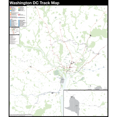
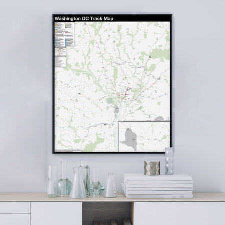
The Complete and Geographically Accurate track map of Washington DC is a new, detailed look at the entire rail network that most riders never see. Unlike a traditional subway map which just shows train routes, stations, and a simplified geography for easier navigation, the Track Map shows how the system actually looks; each track, each switch, each station platform and each train yard is shown in a clear and clean design. While the Track Map offers a service guide, it is not intended to replace the subway map as a wayfinding tool. The Track Map shows the paths of the tracks so that the viewer can see how trains are able to run. If you’ve ever wondered why certain trains don’t run to certain places, this map will tell you why.
The idea behind this was to remove all distortion from traditional subway maps and see the system down to its bones. Street labels, parks, cemeteries, and airports help act as landmarks. The more complicated interchanges and interlockings are shown in a blown up detail section along with a list of as many provisions and abandoned sections of the system I have discovered.
Fine art prints are made in Williamsburg, Brooklyn NY on Semi-Gloss, 10mil Premium Luster Paper.
Select options This product has multiple variants. The options may be chosen on the product page -
 Price range: $30.00 through $80.00
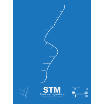
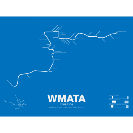
The Blue Line was the second section of the Washington Metro to open; on July 1st 1977 trains began running the familiar serpentine route from National Airport through Roslyn and Metro Center (at the time the only transfer station) to Stadium-Armory. In 1978 an extension to New Carrollton opened and service was split between Blue Line trains running from National Airport-New Carrollton and Orange Line trains running the reverse direction. When the Orange Line extension to Ballston opened a year later Blue Line trains were cut back to Stadium-Armory.
When the Addison Road branch opened in 1980 the Blue Line once again ran only one direction while Orange Line trains ran in the other direction, this time on both branches. In 1983 the Yellow Line was opened down to Huntington. This was originally to be the new terminal for Blue Line trains but due to a car shortage the Yellow Line, which required fewer cars, was extended instead, and this service pattern remains to this day. The extension to Van Dorn St (the originally planned terminal for the Yellow Line) didn’t open until 1991 and was extended to Franconia-Springfield in 1997. A final extension to Largo Town Center opened in 2004.
The Blue Line holds the distinction of the line which shares the most amount of track with other lines (the Orange and Yellow lines). In fact during rush hour service only the Arlington Cemetery station is served exclusively by Blue Line trains. Because of this, planners are looking at digging a new tunnel through central D.C. once the Silver Line opens which is also slated to share Blue Line tracks through downtown D.C.
Printed on Satin finish 80# cover stock – 220 GSM. Made in the USA! Standard production time is 5 Days. Please add more time for shipping.
Select options This product has multiple variants. The options may be chosen on the product page -
 Price range: $30.00 through $80.00
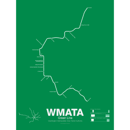
The Green Line was the final section of the original Washington Metro to open with trains not running until December 1991. While planning for the Green Line began at the same time as the rest of the system it was decided in 1977 to develop the route last. This decision sparked much controversy because the Green Line runs through areas of the city which are the poorest and most transit dependent.
Legal and funding issues dogged construction of the line. Station locations were also subject to much controversy and the ultimate route changed often. The northern section was to run in the median of the North Central Freeway but had to be changed when the freeway was canceled.
The Green Line shares its route through central D.C. with the Yellow Line. The first section ran from U St to Anacostia. Due to controversy over the route from U St to Fort Totten a small section of the Green Line from Fort Totten to Greenbelt opened first in 1993 with no physical connection to the other section of Green Line.
While the final section of subway from U St to Fort Totten was under construction some Green Line trains ran along the Red Line from West Hyattsville to Farragut North using a single non-revenue track connecting each line. In 1999 the connection between U St and Fort Totten was finally opened. In 2001 the Green Line was extended south to Branch Ave, thus completing the originally planned system 25 years after the first section was opened and 46 years after planning began.
Printed on Satin finish 80# cover stock – 220 GSM. Made in the USA! Standard production time is 5 Days. Please add more time for shipping.
Select options This product has multiple variants. The options may be chosen on the product page -
 Price range: $30.00 through $80.00
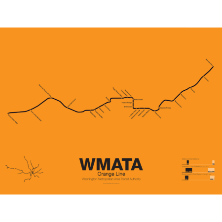
The Orange Line was the third leg of the Washington Metro to open, though service began running in 1978 as a one way service along the existing Blue Line from New Carrollton to National Airport. It wasn’t until a year later in 1979 that the Orange Line was extended out to Ballston when it began running in both directions. In 1986 the line was extended out to Vienna. Plans at the time to reroute the line through the fast developing Tysons Corner were eventually dropped to prevent a five year delay in construction.
These plans were resurrected with the Silver Line being built through Tysons Corner on its way to Dulles Airport. The Orange Line through Virginia runs along the median of Interstate 66 from Vienna to Falls Church. Originally the line was to run along the median of I-66 through Arlington but city planners rerouted it through downtown Arlington which helped stimulate dense residential development in central Arlington.
From Roslyn to Stadium-Armory the Orange and Blue lines share their downtown subway tunnel and split after ascending to the surface on a bridge over the Anacostia River. From here the Orange Line runs alongside the CSX/Amtrak ROW to New Carrollton.
Printed on Satin finish 80# cover stock – 220 GSM. Made in the USA! Standard production time is 5 Days. Please add more time for shipping.
Select options This product has multiple variants. The options may be chosen on the product page